 GeoMIS.Th
Digitale Übersichtskarte 1:250 000 - Verwaltungsausgabe
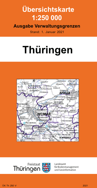
Die Übersichtskarte 1:250 000 ist von der Topographischen Karte 1:200 000 abgeleitet, aktualisiert, jedoch in ihrer Farbgebung verändert und mit einer Geländeschummerung versehen. Die Verwaltungsausgabe - UK Th 250 V - enthält außer dem Relief den gleichen Inhalt, jedoch nur in zweifarbiger Darstellung als Hintergrundinformation. Die Verwaltungsgliederung bis zu den Gemeinden und Verwaltungsgemeinschaften ist in einer speziellen Farbe besonders hervorgehoben.
Simple
- Alternativtitel
-
Digitale Topographische Karten
- Alternativtitel
-
ÜK Th 250 V
- Datumsangaben (Überarbeitung)
- 2021-01-01
- Identifikator
- https://registry.gdi-de.org/id/de.th.csw/6013b10b-2a1a-4a00-8e39-d5dc64aeeab7
- Präsentationsform
- Digitale Karte
- Bearbeitungsstatus
- Kontinuierliche Aktualisierung
- Überarbeitungsintervall
- Bei Bedarf
- Datenpflegebereich
- Datenbestand
- Keywords
-
-
Rasterdaten
-
Übersichtskarte
-
DTK
-
Grenzen
-
AdVMIS
-
GOVE
-
opendata
-
- Zugriffseinschränkungen
- Benutzerdefinierte Einschränkungen
- Andere Einschränkungen
- Es gelten keine Zugriffsbeschränkungen
- Nutzungseinschränkungen
- Benutzerdefinierte Einschränkungen
- Andere Einschränkungen
-
Es gelten die Lizenzbedingungen „Datenlizenz Deutschland - Namensnennung - Version 2.0“ bzw. „dl-de/by-2-0” ( https://www.govdata.de/dl-de/by-2-0) mit den dort geforderten Angaben zum Quellenvermerk. Als Rechteinhaber und Bereitsteller ist die Datenhaltende Stelle, sowie das Jahr des Datenbezugs in Klammern anzugeben. Beispiel für Quellenvermerk: GDI-Th (2021) Datenlizenz Deutschland - Namensnennung - Version 2.0 (www.govdata.de/dl-de/by-2-0).
- Andere Einschränkungen
-
{
"id": "dl-by-de/2.0",
"name": "Datenlizenz Deutschland Namensnennung 2.0",
"url": " https://www.govdata.de/dl-de/by-2-0",
"quelle": "© GDI-Th"
}
- Räumliche Darstellungsart
- Raster, Gitter
- Massstabszahl
- 250000
- Sprache
- Deutsch
- Thematik
-
- Planungsunterlagen, Kataster
- Beschreibung
-
Thüringen
))
- Identifikator des Referenzsystems
- 25832
- Abgabeformat
-
-
Shape
(
keine
)
-
Shape
(
keine
)
Vertriebsstelle
+49 361 57-4176 759
- Kosten
-
keine
- Bestellhinweise
-
keine
- Lieferzeit
-
keine
- Online
- ATOMFeed für pre-defined Atom Datensätze, Übersichtskarten/Thematische Übersichtskarten ( WWW:DOWNLOAD-1.0-http--download )
- Online
-
Download Offene Geodaten
(
WWW:LINK-1.0-http--download
)
Downloadbereich auf Geoportal Thüringen
- Bezugsebene
- Datenbestand
Konformitätsergebnis
- Alternativtitel
-
Digitale Topographische Karten
- Datumsangaben (Überarbeitung)
- 2017-07-01
- Identifikator
- https://registry.gdi-de.org/id/de.th.csw/6013b10b-2a1a-4a00-8e39-d5dc64aeeab7
- Präsentationsform
- Digitale Karte
- Erklärung
-
vollständig
- Bestanden
- Ja
- Erläuterung
-
generalisiert
- Metadatensatzidentifikator
- 6013b10b-2a1a-4a00-8e39-d5dc64aeeab7 XML
- Sprache
- Deutsch
- Zeichensatz
- Utf8
- Hierarchieebene
- Datenbestand
- Bezeichnung der Hierarchieebene
-
UEK250V
- Datum
- 2026-02-09T11:18:54
- Bezeichnung des Metadatenstandards
-
ISO19115
- Version des Metadatenstandards
-
2003/Cor.1:2006
+49 361 57-4176 799
https://tlbg.thueringen.de/