 GeoMIS.Th
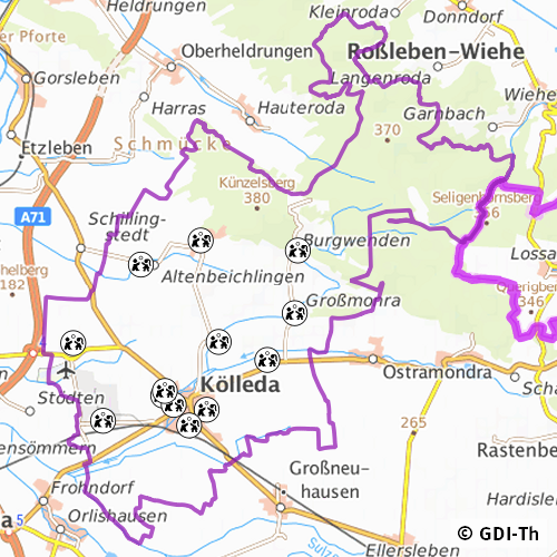
Spielplätze der Stadt Kölleda
Der Datensatz zeigt die Standorte der frei zugänglichen Spielplätze der Stadt Kölleda. Es handelt sich um einen Sekundärdatenbestand.
Simple
- Datumsangaben (Überarbeitung)
- 2025-12-12
- Identifikator
- https://registry.gdi-de.org/id/de.th.csw/68034e0d-2db4-4416-a11e-19169e121c9f
- Bearbeitungsstatus
- Kontinuierliche Aktualisierung
https://www.koelleda.de
- Überarbeitungsintervall
- Bei Bedarf
- Datenpflegebereich
- Datenbestand
-
GEMET - INSPIRE themes, version 1.0
-
-
Bodennutzung
-
- Keywords
-
-
Thüringen
-
Spielplatz
-
opendata
-
GOVE
-
REGI
-
SOCI
-
EDUC
-
- Anwendungseinschränkungen
-
Nutzungsbedingungen: Für diesen Datensatz gelten die Nutzungsbedingungen nach der Datenlizenz Deutschland-Namensnennung, zurzeit in der Version 2.0 ( https://www.govdata.de/dl-de/by-2-0) unter Verwendung des Quellvermerkes "© GDI-Th".
- Zugriffseinschränkungen
- Benutzerdefinierte Einschränkungen
- Nutzungseinschränkungen
- Benutzerdefinierte Einschränkungen
- Andere Einschränkungen
-
Nutzungsbedingungen: Datenlizenz Deutschland-Namensnennung 2.0 in JSON Syntax
- Andere Einschränkungen
-
{"id": "dl-by-de/2.0", "name": "Datenlizenz Deutschland Namensnennung 2.0", "url": " https://www.govdata.de/dl-de/by-2-0 ", "quelle": "© GDI-Th"}
- Räumliche Darstellungsart
- Vektor
- Massstabszahl
- 500
- Sprache
- Deutsch
- Zeichensatz
- Utf8
- Thematik
-
- Gesellschaft
- Beschreibung
-
Stadt Kölleda
- Code
- 160680034034
))
- Identifikator des Referenzsystems
- http://www.opengis.net/def/crs/EPSG/0/25832
- Abgabeformat
-
-
ESRI Shapefile
(
1.0
)
-
ESRI Shapefile
(
1.0
)
- Online
-
Darstellungsdienst für kommunale Geodaten
(
OGC:WMS-http-get-map
)
Web Map Service (WMS) - Darstellungsdienst für alle in der GDI-Th veröffentlichten kommunalen Geodaten
- Online
-
Downloaddienst für kommunale Geodaten
(
OGC:WFS-http-get-capabilities
)
Web Feature Service (WFS) - Downloaddienst für die in der GDI-Th veröffentlichten kommunalen Geodaten
- Online
-
Direktdownload Spielplätze
(
WWW:DOWNLOAD-1.0-http--download
)
Direktdownload Spielplätze der Stadt Kölleda. (Format: Shapefile)
- Bezugsebene
- Datenbestand
Konformitätsergebnis
- Alternativtitel
-
INSPIRE Daten Spezifikation für Bodennutzung - Technische Richtlinien
- Datumsangaben (Publikation)
- 2013-12-10
- Erklärung
-
Originäre Daten
- Bestanden
- Nein
Konformitätsergebnis
- Alternativtitel
-
Verordnung der EU Kommission Richtlinie Nr. 1205/2008, Artikel 4, Teil D
- Datumsangaben (Publikation)
- 2008-12-03
- Präsentationsform
- Digitales Dokument
- Erklärung
-
mit GDI_DE Testsuite validiert
- Bestanden
- Ja
Konformitätsergebnis
- Alternativtitel
-
Verordnung der EU Kommission Richtlinie Nr. 1089/2010
- Datumsangaben (Publikation)
- 2010-12-08
- Präsentationsform
- Digitales Dokument
- Erklärung
-
Originäre Daten
- Bestanden
- Nein
Konformitätsergebnis
- Alternativtitel
-
Verordnung der EU Kommission 2023/2431
- Datumsangaben (Publikation)
- 2023-10-24
- Präsentationsform
- Digitales Dokument
- Erklärung
-
Originäre Daten
- Bestanden
- Nein
- Erläuterung
-
Grundlage amtl. Flurkarte, Orthophoto
- Metadatensatzidentifikator
- 68034e0d-2db4-4416-a11e-19169e121c9f XML
- Sprache
- Deutsch
- Zeichensatz
- Utf8
- Hierarchieebene
- Datenbestand
- Bezeichnung der Hierarchieebene
-
Spielplaetze
- Datum
- 2025-12-12T08:28:46
- Bezeichnung des Metadatenstandards
-
ISO 19115/19119
+49 361 574176 759