 GeoMIS.Th
INSPIRE PLU ATOMFeed Stadt Weimar
Downloaddienst für Geodaten des INSPIRE Annex Themas Geplante Bodennutzung der Stadt Weimar
Simple
Basisinformation
- Alternativtitel
-
INSPIRE PLU Downloaddienst der Stadt Weimar
- Datumsangaben (Überarbeitung)
- 2026-06-05
- Identifikator
- https://registry.gdi-de.org/id/de.th.csw/e3e98553-6606-460c-8d82-45f880c95117
- Bearbeitungsstatus
- Kontinuierliche Aktualisierung
https://stadtplan.weimar.de
- Überarbeitungsintervall
- Bei Bedarf
- Datenpflegebereich
- Service
- Keywords
-
-
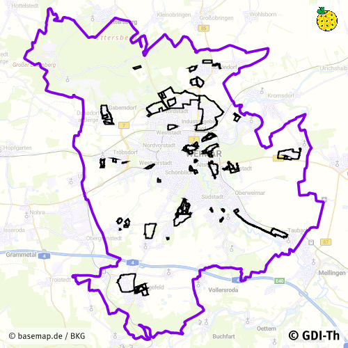
Bebauungspläne
-
B-Plan-Umringe
-
Bauleitplanung
-
Geltungsbereiche
-
Weimar
-
opendata
-
GOVE
-
REGI
-
Thüringen
-
inspireidentifiziert
-
Georedakteur_Kommunal
-
-
GEMET - INSPIRE themes, version 1.0
-
-
Bodennutzung
-
-
VERORDNUNG (EG) Nr. 1205/2008 DER KOMMISSION zur Durchführung der Richtlinie 2007/2/EG des Europäischen Parlaments und des Rates hinsichtlich Metadaten
-
-
Download-Dienste
-
infoFeatureAccessService
-
-
High-value dataset categories
-
-
Erdbeobachtung und Umwelt
-
- Zugriffseinschränkungen
- Benutzerdefinierte Einschränkungen
- Andere Einschränkungen
- Es gelten keine Zugriffsbeschränkungen
- Anwendungseinschränkungen
-
Nutzungsbedingungen: Für diesen Datensatz gelten die Nutzungsbedingungen nach der Datenlizenz Deutschland-Namensnennung, zurzeit in der Version 2.0 ( https://www.govdata.de/dl-de/by-2-0) unter Verwendung des Quellvermerkes "© GDI-Th".
- Zugriffseinschränkungen
- Benutzerdefinierte Einschränkungen
- Nutzungseinschränkungen
- Benutzerdefinierte Einschränkungen
- Andere Einschränkungen
-
Nutzungsbedingungen: Datenlizenz Deutschland-Namensnennung 2.0 in JSON Syntax
- Andere Einschränkungen
-
{"id": "dl-by-de/2.0", "name": "Datenlizenz Deutschland Namensnennung 2.0", "url": " https://www.govdata.de/dl-de/by-2-0 ", "quelle": "© GDI-Th"}
- Art des Dienstes
- download
- Version des Dienstes
-
predefined ATOM
- Beschreibung
-
Stadt Weimar
- Code
- 160550000000
))
Angehängte Ressource
- Name der Operation
-
GetCapabilities
- Identifikator/Bezeichnung
-
a4a94e66-54f6-4d87-80ff-c838695dbab3
- Art der Kopplung
- Eng
Funktionen und Operationen
- Name der Operation
-
GetCapabilities
- DCP (Distributionsplattform)
- XML
- Verknüpfungspunkt (URL)
- INSPIRE pre-defined ATOM Feed
- Bezieht sich auf
- Identifikator des Referenzsystems
- http://www.opengis.net/def/crs/EPSG/0/25832
- Abgabeformat
-
-
GML
(
INSPIRE GML
)
-
GML
(
INSPIRE GML
)
- Online
-
AtomFeed für Inspire Geodaten des INSPIRE Annex Themas Geplante Landnutzung der Stadt Weimar.
(
WWW:LINK-1.0-http--rss
)
Downloaddienst für Inspire Geodaten des INSPIRE Annex Themas Geplante Landnutzung der Stadt Weimar.
- Online
-
INSPIRE PLU WMS Stadt Weimar
(
OGC:WMS-http-get-map
)
Darstellungsdienst INSPIRE PLU WMS der Stadt Weimar
- Bezugsebene
- Service
- Andere
-
service
Konformitätsergebnis
- Alternativtitel
-
Verordnung der EU Kommission Richtlinie Nr. 1205/2008, Artikel 4, Teil D
- Datumsangaben (Publikation)
- 2008-12-03
- Präsentationsform
- Digitales Dokument
- Erklärung
-
mit GDI-DE Testsuite validiert
- Bestanden
- Ja
Konformitätsergebnis
- Datumsangaben (Publikation)
- 2009-10-20
- Präsentationsform
- Digitales Dokument
- Erklärung
-
mit GDI-DE Testsuite validiert
- Bestanden
- Ja
Konformitätsergebnis
- Datumsangaben (Publikation)
- 2013-08-09
- Identifikator
- Downloaddienst
- Erklärung
-
mit GDI-DE Testsuite validiert
- Bestanden
- Ja
- Metadatensatzidentifikator
- 85fe2b03-a8f6-4da8-bf43-9314c755c959 XML
- Sprache
- Deutsch
- Zeichensatz
- Utf8
- Hierarchieebene
- Service
- Bezeichnung der Hierarchieebene
-
INSPIRE PLU ATOMFeed Stadt Weimar
- Datum
- 2026-06-05T09:52:23
- Bezeichnung des Metadatenstandards
-
ISO 19115/19119
https://stadtplan.weimar.de