 GeoMIS.Th
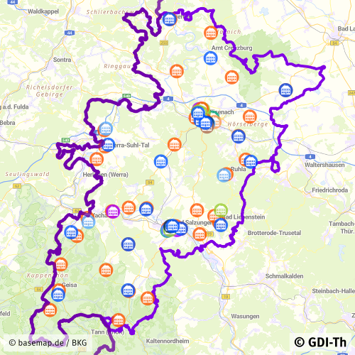
Schulstandorte des Wartburgkreises
Dieser Datenbestand stellt die Schulstandorte des Wartburgkreises dar.
Simple
- Alternativtitel
-
Schulstandorte des Wartburgkreises
- Datumsangaben (Überarbeitung)
- 2026-06-22
- Identifikator
- https://registry.gdi-de.org/id/de.th.csw/90383268-aff0-43bf-870e-a30f36ee4680
- Bearbeitungsstatus
- Kontinuierliche Aktualisierung
+49 3695 61-6499
http://www.wartburgkreis.de
- Überarbeitungsintervall
- Jährlich
- Datenpflegebereich
- Datenbestand
- Keywords
-
-
Schulen
-
Schulstandorte
-
Grundschule
-
Förderschule
-
Musikschule
-
Berufsschule
-
Gemeinschaftsschule
-
Schule in freier Trägerschaft
-
Volkshochschule
-
Regelschule
-
Gymnasium
-
utilitiesCommunication
-
Ver- und Entsorgung/Nachrichtenwesen
-
-
GEMET - INSPIRE themes, version 1.0
-
-
Versorgungswirtschaft und staatliche Dienste
-
- Anwendungseinschränkungen
-
Nutzungsbedingungen: Für diesen Datensatz gelten die Nutzungsbedingungen nach der Datenlizenz Deutschland-Namensnennung, zurzeit in der Version 2.0 ( https://www.govdata.de/dl-de/by-2-0) unter Verwendung des Quellvermerkes "© GDI-Th".
- Zugriffseinschränkungen
- Benutzerdefinierte Einschränkungen
- Nutzungseinschränkungen
- Benutzerdefinierte Einschränkungen
- Andere Einschränkungen
-
Nutzungsbedingungen: Datenlizenz Deutschland-Namensnennung 2.0 in JSON Syntax
- Andere Einschränkungen
-
{"id": "dl-by-de/2.0", "name": "Datenlizenz Deutschland Namensnennung 2.0", "url": " https://www.govdata.de/dl-de/by-2-0 ", "quelle": "© GDI-Th"}
- Räumliche Darstellungsart
- Vektor
- Massstabszahl
- 300000
- Sprache
- Deutsch
- Zeichensatz
- Utf8
- Thematik
-
- Ver- und Entsorgung, Kommunikation
- Beschreibung
-
Wartburgkreis
))
- Identifikator des Referenzsystems
- http://www.epsg.org / http://www.opengis.net/def/crs/EPSG/0/25832
- Abgabeformat
-
-
ESRI Shapefile
(
1.0
)
-
ESRI Shapefile
(
1.0
)
- Online
-
Darstellungsdienst für kommunale Geodaten
(
OGC:WMS-http-get-map
)
Web Map Service (WMS) - Darstellungsdienst für alle in der GDI-Th veröffentlichten kommunalen Geodaten
- Online
-
Direktdownload Schulstandorte
(
WWW:DOWNLOAD-1.0-http--download
)
Direktdownload - Schulstandorte des Wartburgkreises
- Online
- Internetauftritt Landratsamt Wartburgkreis ( WWW:LINK-1.0-http--link )
- Bezugsebene
- Datenbestand
Konformitätsergebnis
- Alternativtitel
-
INSPIRE Specification - Versorgungswirtschaft und staatliche Dienste
- Datumsangaben (Publikation)
- 2013-12-10
- Identifikator
- Versorgungswirtschaft und staatliche Dienste
- Präsentationsform
- Digitales Dokument
- Erklärung
-
Originäre Daten
- Bestanden
- Ja
Konformitätsergebnis
- Alternativtitel
-
Verordnung der EU Kommission Richtlinie Nr. 1205/2008, Artikel 4, Teil D
- Datumsangaben (Publikation)
- 2008-12-03
- Präsentationsform
- Digitales Dokument
- Erklärung
-
mit GDI-DE Testsuite validiert
- Bestanden
- Ja
Konformitätsergebnis
- Datumsangaben (Publikation)
- 2010-12-08
- Präsentationsform
- Digitales Dokument
- Erklärung
-
Originäre Daten
- Bestanden
- Ja
- Erläuterung
-
Landratsamt Wartburgkreis, Adressen vom Schulamt
- Metadatensatzidentifikator
- 90383268-aff0-43bf-870e-a30f36ee4680 XML
- Sprache
- Deutsch
- Zeichensatz
- Utf8
- Hierarchieebene
- Datenbestand
- Bezeichnung der Hierarchieebene
-
Wartburgkreis Schulstandorte
- Datum
- 2026-06-22T14:04:01
- Bezeichnung des Metadatenstandards
-
ISO 19115/19119
+49 3695 61-6499
http://www.wartburgkreis.de