 GeoMIS.Th
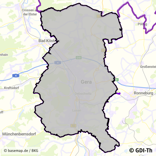
Flächennutzungsplan Stadt Gera
Dieser Datensatz enthält den originären Flächennutzungsplan der Stadt Gera.
Simple
- Datumsangaben (Überarbeitung)
- 2023-06-22
- Identifikator
- https://registry.gdi-de.org/id/de.th.csw/160524fa-5db3-4fc3-b478-f14c4d14a836
- Präsentationsform
- Digitale Karte
- Bearbeitungsstatus
- Kontinuierliche Aktualisierung
+49 365 838 1845
https://www.gera.de/
- Überarbeitungsintervall
- Bei Bedarf
- Keywords
-
-
Thüringen
-
Bebauungspläne
-
Satzungen
-
Flächennutzungspläne
-
Bodennutzung
-
opendata
-
REGI
-
GOVE
-
Georedakteur_Kommunal
-
-
GEMET - INSPIRE themes, version 1.0
-
-
Bodennutzung
-
- Anwendungseinschränkungen
-
Nutzungsbedingungen: Für diesen Datensatz gelten die Nutzungsbedingungen nach der Datenlizenz Deutschland-Namensnennung, zurzeit in der Version 2.0 ( https://www.govdata.de/dl-de/by-2-0) unter Verwendung des Quellvermerkes "© GDI-Th".
- Zugriffseinschränkungen
- Benutzerdefinierte Einschränkungen
- Nutzungseinschränkungen
- Benutzerdefinierte Einschränkungen
- Andere Einschränkungen
-
Nutzungsbedingungen: Datenlizenz Deutschland-Namensnennung 2.0 in JSON Syntax
- Andere Einschränkungen
-
{"id": "dl-by-de/2.0", "name": "Datenlizenz Deutschland Namensnennung 2.0", "url": " https://www.govdata.de/dl-de/by-2-0 ", "quelle": "© GDI-Th"}
- Räumliche Darstellungsart
- Vektor
- Massstabszahl
- 750000
- Sprache
- Deutsch
- Thematik
-
- Planungsunterlagen, Kataster
- Beschreibung
-
Stadt Gera
- Code
- 1605200000000
))
- Identifikator des Referenzsystems
- http://www.opengis.net/def/crs/EPSG/0/25832
- Abgabeformat
-
-
GML
(
GML 3.2
)
-
GML
(
GML 3.2
)
+49 365 838 1845
https://www.gera.de/
- Online
-
Darstellungsdienst für kommunale Geodaten
(
OGC:WMS-http-get-map
)
Web Map Service (WMS) - Darstellungsdienst für alle in der GDI-Th veröffentlichten kommunalen Geodaten
- Online
-
Direktdownload Flächennutzungspläne
(
WWW:DOWNLOAD-1.0-http--download
)
Direktdownload - Flächennutzungspläne der Stadt Gera
- Online
-
Darstellungsdienst GeoPortal Gera
(
OGC:WMS-http-get-map
)
Web Map Service (WMS) - Darstellungsdienst GeoPortal Gera
- Bezugsebene
- Datenbestand
Konformitätsergebnis
- Alternativtitel
-
INSPIRE Specification - Bodennutzung
- Datumsangaben (Publikation)
- 2013-12-10
- Identifikator
- Bodennutzung
- Präsentationsform
- Digitales Dokument
- Erklärung
-
mit GDI-DE Testsuite validiert
- Bestanden
- Ja
Konformitätsergebnis
- Alternativtitel
-
Verordnung der EU Kommission Richtlinie Nr. 1205/2008, Artikel 4, Teil D
- Datumsangaben (Publikation)
- 2008-12-03
- Präsentationsform
- Digitales Dokument
- Erklärung
-
mit GDI-DE Testsuite validiert
- Bestanden
- Ja
Konformitätsergebnis
- Datumsangaben (Publikation)
- 2010-12-08
- Präsentationsform
- Digitales Dokument
- Erklärung
-
mit GDI-DE Testsuite validiert
- Bestanden
- Ja
- Erläuterung
-
Datenbestandsüberführung kommunaler Daten in das INSPIRE Modell Bodennutzung
- Metadatensatzidentifikator
- 97b7f502-2b0d-4b46-b822-8400540c2fdc XML
- Sprache
- Deutsch
- Zeichensatz
- Utf8
- Hierarchieebene
- Datenbestand
- Datum
- 2026-01-05T14:48:39
- Bezeichnung des Metadatenstandards
-
ISO 19115/19119
+49 365 838 1845
https://www.gera.de/