 GeoMIS.Th
ATOMFeed_DTK25
Im Zuge des Aufbaus der Geodateninfrastruktur des Freistaates Thüringen (GDI-Th) werden internen und externen AnwendernGeobasisdaten zur freien Nutzung (offene Geodaten) bereitgestellt. Hierbei handelt es sich um einen Atom-Feed für DTK25.
Simple
Basisinformation
- Alternativtitel
-
ATOMFeed für pre-defined Atom Datensätze, DTK25
- Datumsangaben (Publikation)
- 2017-01-01
- Identifikator
- https://registry.gdi-de.org/id/de.th.csw/a6982308-0f87-4580-9d94-efdc6910e1d0
- Präsentationsform
- Digitale Tabelle
+49 361 57-4176 759
- Keywords
-
-
Download
-
ATOM FEEDS
-
atomfeeds
-
Karten
-
GOVE
-
opendata
-
-
VERORDNUNG (EG) Nr. 1205/2008 DER KOMMISSION zur Durchführung der Richtlinie 2007/2/EG des Europäischen Parlaments und des Rates hinsichtlich Metadaten
-
-
Download-Dienste
-
infoFeatureAccessService
-
- Zugriffseinschränkungen
- Benutzerdefinierte Einschränkungen
- Andere Einschränkungen
- Es gelten keine Zugriffsbeschränkungen
- Nutzungseinschränkungen
- Benutzerdefinierte Einschränkungen
- Andere Einschränkungen
-
Es gelten die Lizenzbedingungen „Datenlizenz Deutschland - Namensnennung - Version 2.0“ bzw. „dl-de/by-2-0” ( https://www.govdata.de/dl-de/by-2-0) mit den dort geforderten Angaben zum Quellenvermerk. Als Rechteinhaber und Bereitsteller ist die Datenhaltende Stelle, sowie das Jahr des Datenbezugs in Klammern anzugeben. Beispiel für Quellenvermerk: GDI-Th (2021) Datenlizenz Deutschland - Namensnennung - Version 2.0 (www.govdata.de/dl-de/by-2-0).
- Andere Einschränkungen
-
{
"id": "dl-by-de/2.0",
"name": "Datenlizenz Deutschland Namensnennung 2.0",
"url": " https://www.govdata.de/dl-de/by-2-0",
"quelle": "© GDI-Th"
}
- Art des Dienstes
- download
- Version des Dienstes
-
predefined ATOM
- Beschreibung
-
Thüringen
))
- Art der Kopplung
- Eng
Funktionen und Operationen
- Name der Operation
-
GetCapabilities
- DCP (Distributionsplattform)
- XML
- Verknüpfungspunkt (URL)
- ATOMFeed für pre-defined Atom Datensätze, DTK25
- Identifikator des Referenzsystems
- http://www.epsg.org / EPSG:25832
- Abgabeformat
-
-
TIFF
(
gezipt
)
-
TIFF
(
gezipt
)
Vertriebsstelle
+49 361 57-4176 759
- Kosten
-
keine - siehe Datenlizenz Deutschland - Namensnennung;GDI-TH - Version 2.0 (URL: http://www.govdata.de/dl-de/by-2-0)
- Bestellhinweise
-
keine
- Lieferzeit
-
keine
- Bezeichnung
- Online-Verbindung
- Bezugsebene
- Datenbestand
- Datenbestand
-
verschiedene Daten
Konformitätsergebnis
- Alternativtitel
-
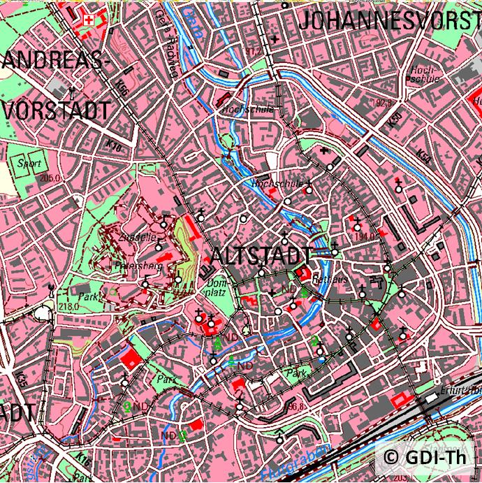
Digitale Topographische Karten
- Datumsangaben (Erstellung)
- 2002-01-01
- Identifikator
- https://registry.gdi-de.org/id/de.th.csw/e01ac9b0-f05e-41d2-91f8-4a0e8f937ac1
- Präsentationsform
- Digitale Karte
- Erklärung
-
nur für das Gebiet Thüringen vorhanden
- Bestanden
- Ja
- Erläuterung
-
keine Angaben
- Metadatensatzidentifikator
- a6982308-0f87-4580-9d94-efdc6910e1d0 XML
- Sprache
- Deutsch
- Zeichensatz
- Utf8
- Hierarchieebene
- Service
- Bezeichnung der Hierarchieebene
-
Downloaddienst
- Datum
- 2022-02-11T09:58:38
- Bezeichnung des Metadatenstandards
-
ISO 19115/19119
+49 361 57-4176 799
https://tlbg.thueringen.de/